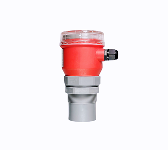
Model: HFT-6813
Protection level: IP66 / IP65
Shell: Aluminum/Plastic
product details
Selling Units: Single item
Single package size: :70*26.5*16.5cm
Single gross weight: 3.00 KG
2.1 Site application characteristics of address disaster:
The high-frequency radar mud level meter and debris flow monitor recommended by the hydrological industry adopt the emission frequency of 26ghz, so it has the following advantages:
small beam angle, concentrated energy, stronger anti-interference ability, greatly improving the measurement accuracy and reliability
the antenna size is small, which is easy to install and add antenna protection devices such as rain cover
light weight, about 2kg, easy to install
the measurement range can reach up to 70m, covering the common debris flow and landslide areas and the on-site measurement requirements
a variety of output circuit interfaces cooperate with the acquisition system to provide both 485 signals and 4-20mA signals to RTU
it can work through rain and fog to prevent measurement error caused by rain and fog
fast response speed, capable of timely measuring data after debris flow
HFT-6813
 | Application: hills, hillsides, canyons, rivers and shoals Medium: debris flow, velocity per second ≤ 10m. Measuring range: 30m, 40m, 50m, 60m, 70m Process connection: g1-1 / 2A thread, support and flange Working environment temperature: - 40 ~ 80 ℃; Working environment pressure: - 0.1 ~ + 0.1MPa Accuracy: ± 10mm Frequency range: 26ghz Protection grade: IP66 / IP65 Power supply: DC (12-24V) / four wire Signal output: RS485 / Modbus Protocol Field display: optional Housing: aluminum / plastic |
l Appearance size:
HFT-6813


Product application:
Mainly used in sewage plant, water plant, mine, water conservancy, power plant, chemical plant, steel plant
The monitoring of waterlogging and water, sewage quality, urban pipeline and rainfall station in the construction of smart city project; applicable to the monitoring of rainfall point of existing water conservancy projects, river water and rain monitoring, reservoir water and rain monitoring, flow station, irrigation area, open channel monitoring, etc.; automatic monitoring of water plant, on-line water quality monitoring and secondary water supply monitoring of smart water project; suitable for intelligent water project It is used for the monitoring of collapse and landslide points, debris flow and surface water level of geological disaster projects

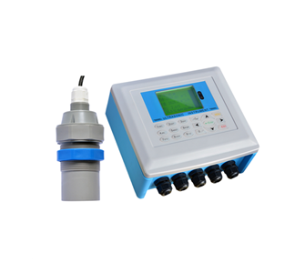
Integrated ultrasonic level meter
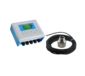
Split ultrasonic open channel flowmeter
Ultrasonic sludge interface instrument

TOP